
Astronaut Photography of Earth - Display Record
ISS002-E-7759
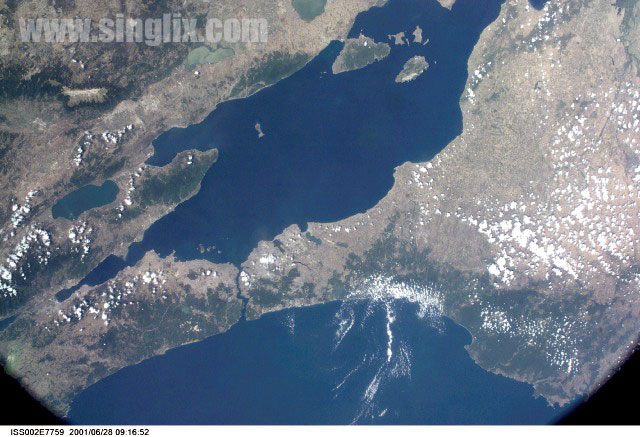
Low-resolution Browse Image
Identification
Mission: ISS002 Roll:
E Frame: 7759 Mission ID on the Film or image: ISS002
Country or
Geographic Name: TURKEY
Features: SEA OF MARMARA
Center Point Latitude: 40.5 Center Point Longitude: 28.0 (Negative numbers indicate south for
latitude and west for longitude)
Stereo:
(Yes indicates there is an adjacent picture of the same
area)
ONC Map ID: JNC Map ID:
Camera
Camera Tilt: High Oblique
Camera Focal Length:
35mm
Camera: E2: Kodak DCS460 Electronic Still Camera
Film:
3060E : 3060 x 2036 pixel CCD, RGBG array.
Quality
Film Exposure:
Percentage
of Cloud Cover: 25 (11-25)
Nadir
Date: 20010628 (YYYYMMDD)GMT Time: 091652
(HHMMSS)
Nadir Point Latitude: -34.2, Longitude: -171.3
(Negative numbers indicate south for latitude and west for
longitude)
Nadir to Photo Center Direction: East
Sun Azimuth:
258 (Clockwise angle in degrees from north to the sun measured at the
nadir point)
Spacecraft Altitude: 200 nautical miles (370
km)
Sun Elevation Angle: -59 (Angle in degrees between the
horizon and the sun, measured at the nadir point)
Orbit Number:
2884